
My long run this weekend ended up being a solo affair. I chose Big River since I hadn't been there in awhile and figured it'd be good to run some of the trails before the 4th Season finale 1/2 marathon on the 30th. I wasn't quite sure about the route for that race but I knew that it went around Carr Pond. I assume that at least some of the trails I hit will be part of the race. I brought my iPod Touch and took pictures - it's not the best camera so I apologize in advance for the crappy pictures.
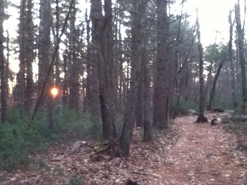 |
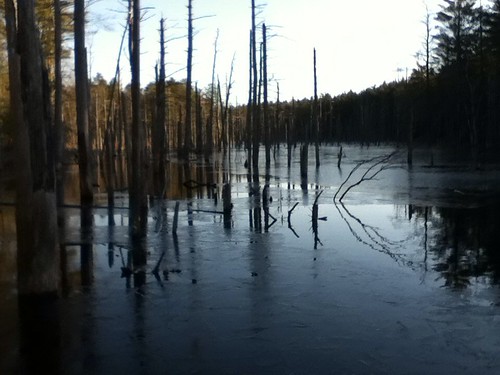
| Mornin' in Big River |
I parked at the lot on Hopkins Hill Rd at 6:40 AM. Two cars were already there. One guy was reading the paper and soon left. The other appeared to be a disheveled person sleeping in a minivan. A little sketchy but I knew the lot would soon be filled with mountain bikers so off I went. The sun was just starting to climb through the trees as I made my way down towards Carr Pond.
It was chilly to start but I went with shorts and a compression top. My legs warmed up soon enough and I appreciated all the pockets in the shorts for carrying my supplies. I carried my iPod on one of those arm straps. At first sliding it off to snap a few pictures proved annoying as my body cooled but after a few miles I was properly warmed up and the brief stops didn't bother me.
 The trail stayed away from Carr Pond until it reached the east shore. There are plenty of rock formations which look out over the water, providing a great vantage point. These rock sites appear popular with campers and cavorters, as there's plenty of evidence of fire pits and trash. Pick up your crap, people!
From this point there's a wide trail that runs around Carr Pond. I wanted to see more of this area so I found trails carrying me east. I had a great map from NEMBA that listed roads and landmarks. I knew that the eastern the Big River boundary was Carr Pond Rd. I also saw "Water Tank" marked on the map. I began to do some start/stop exploration, taking trails until I hit the road and then backtracking. This didn't make for a very smooth/continuous run but I enjoyed feeling my way around the outskirts of BR.
 |
| Hard to miss |
I had a good idea of where I was and then I saw a giant white thing through the trees. Yep, there's the water tank. Location confirmed, I wanted to try to make my way up the start/finish of the half marathon. I proceeded west a little ways on a fairly open trail as the sounds of the highway slowly grew louder.
Eventually this trail turned north and then hit a wide dirt road that went straight in both directions. I didn't realize it at the time but this was the New London Turnpike - I've travelled on it over on the west side of BR.
The New London was a straight shot up to Division Rd, an actual paved road. I saw a parking lot nearby and I'm assuming this is where we'll meet for the race as it's close to Exit 7 on 95. I wanted to get away from the cars and back into the woods so I backtracked and jumped on the first trail I found. Turns out this trail just ran alongside Division Rd for awhile. So much for escaping. I did however discover a beat-up old structure and thought it necessary to take it's picture.
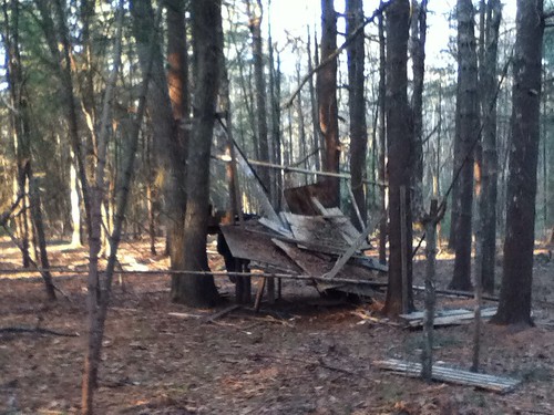 |
| Perfect place for a nap |
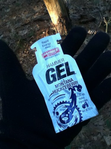 |
| Stop! Hammer Gel! |
Mini Review: I used a couple of the Hammer Gels I grabbed at Ocean's Run last week. Normally I don't care for berry flavors but the huckleberry was good. And the gel almost has tiny tiny particles in it which give it a nice texture you don't get from most other gels. I like 'em.
So I ran alongside Division Rd for a while before the trail looped around through some old farmland and back into the woods where it intersected with the New London dirtpike again. Now I followed it in the other direction for a ways as I knew it would take me over to the sand dunes, an area I had not yet checked out. It's a cool location: big sand dunes and prairie grass. I kept expecting Mad Max refugees to appear on ATVs and ride me down. I did a loop around the "desert" before returning to the woods.
 |
| A dirt biker's paradise |

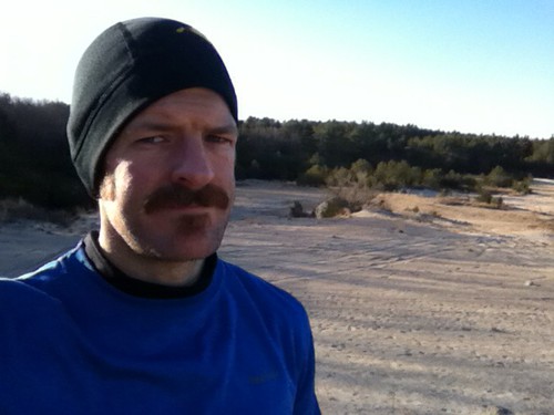 |
| Just a handsome man scopin' out some dunes |
 |
| "Run for your life! The bandits are coming!" |
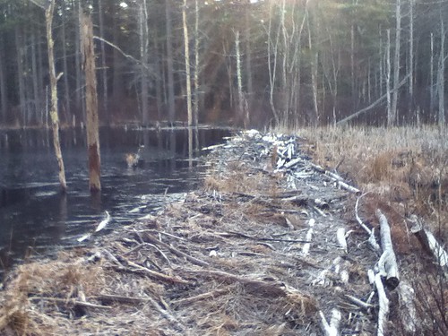 Once in the woods, I made my way back to the east side of Hopkins Hill Rd. I took a side trail which turned out to be some sort of super hilly mogul run. BMXers might enjoy this but it was brutal on my legs. Finally jumped on a more pleasant trail and took it east until it hit Tarbox pond. There I ran into a beaver dam (one of many I saw today.) The path across the dam looked dicey and since I was only at mile 8 of a planned 16 miles I decided to head north around the pond instead.
I followed the trail, keeping Tarbox Pond to my right, until the trail straightened out and became wider. I could've jumped off it to head in a more easterly direction but I have a hard time abandoning these faster dirt trail/roads - I like to see where they go. This one ended up reconnecting me with the New London dirtpike. There was also an extremely creepy building at the intersection that I had somehow not seen on my first pass.
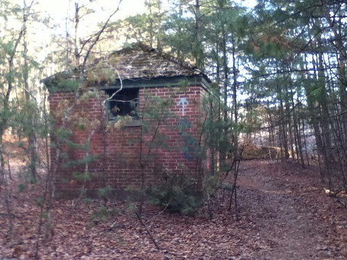 |
| I hope no one's home |
 |
| Come on in! We have cookies! |
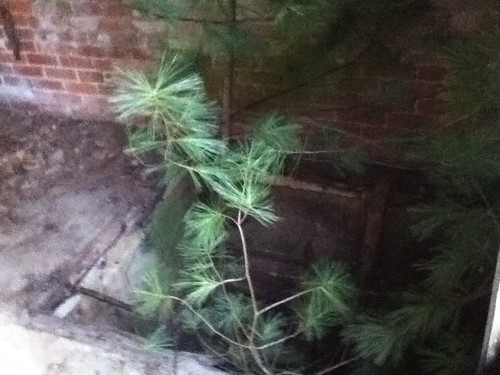 |
| A tree was growing through a hole in the floor. Crazy. |
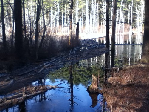 |
| Same beaver dam from the other side of the pond |
I ened up following the trail around Carr until I picked up the same trail I originally ran. Followed it all the way back to the car. The last uphill section was more than enough to finish me off but because I'm a sucker I took another trail out for .2 miles in order to hit 16 on the nose. A great run in a beautiful place. Looking forward to the half marathon!
Looks like a really cool place, I really need to get over there soon...like before the 30th...great write-up, and great pictures, keep 'em coming!
ReplyDeleteAwesome (your mustache). The run looks pretty sweet too :)
ReplyDeleteThe disheveled person sleeping in the minivan - was it Galoob? :)
ReplyDeleteSeriously, cool pics and write-up. Nice run!
Great run recap! I always wondered what people used to take pictures on the run.
ReplyDeleteI can't wait to run in Big River!! Looks awesome, with different types of terrain.