Several months ago Amanda and I booked a stay at the Greenleaf Hut on the slope of Mt. Lafayette for October. I was going to take us over the very popular Franconia ridgeline hitting all the summits from Lafayette to Flume. Things change and Amanda was no longer going with me so that prompted me to expand this trip and turn it into a longer solo adventure. With the hut stay on a Friday night, I thought why not try to tackle the whole Pemi Loop? Not wanting to stay at the Guyot Campsite on a Saturday night (I heard it gets crazy busy) I decided I would do the loop counter clockwise, hiking to the Bonds and staying at the Guyot Campsite on Thursday night, following the Garfield ridgeline to the Greenleaf Hut for Friday and then finishing with the Franconia Ridgeline on Saturday. The weather was forecast to be clear and beautiful for Thursday and Saturday but it looked like rain was definitely coming on Friday. I was prepared to forge ahead anyway and trust that my gear was sufficient.
I drove up to Dover, NH on Wednesday and stayed with my friend Rob. He was actually planning to do some hiking in the Whites on Saturday as well so we arranged for him to meet me at the Greenleaf Hut on Saturday morning. He'd have to leave pretty early to make it from Dover to the hut at a reasonable hour but I knew Rob was the sort of stubborn guy to get it done.
Thursday morning I left Dover at 6:30 AM, stopped at the White Mountain Visitor Center to get a week parking pass and was told by the old ladies there that it was going to be crazy packed with tourists this weekend. Good thing I'm heading in early. I parked at the Lincoln Woods lot which is a few miles down the road on the Kangamagus Highway. I had a few false starts as I kept forgetting bits of gear in the car (I had already crossed the bridge when I realized I didn't have my sunglasses) but finally I was off and hiking by 9:15 AM.
I took a long break here and had some lunch. The climb from here to Mt. Bond was short but steep. I took another break at Bond and a passerby snapped a picture for me. I also had phone reception and was able to send out a text to my wife to let her know my first day was almost done. Then it was an easy descent to the Guyot campsite where I was still paranoid about scoring a tent platform. That fear proved to be unnecessary as the place was completely deserted - even the caretaker tent was gone. I had planned to stay at Guyot because I was nervous about camping by myself and yet here I was. Luckily a group of three showed up an hour later so I wouldn't be completely alone.
 |
| Happy to see this sign |
 |
| Tricky to scale this with a heavy pack |
 |
| Incredible views from Bondcliff |
 |
| Just imagine I'm standing there on the cliff |
 |
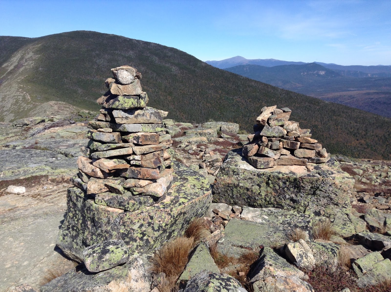
| Cairns |
 |
| View from Mt Bond - Washington and the Presidentials in the background |
With my tent set up I ventured back up the trail to tag West Bond and enjoy the sunset over Franconia ridge. I mistimed it badly and had to spend 45 minutes up there before it set. But the views were enchanting and my synthetic coat kept me warm. It also gave me time to reflect. Then I returned to the darkening camp and made dinner in the "kitchen" using my whisperlite stove and one of those rehydrated backpacker meals (Beef Pho - good!) With my belly full and complete darkness achieved at 7:30 PM I decided to turn in since it was going to be a cold night (28 degrees!) I can't say I slept all that well. I woke up every hour or so due to the cold and used some well placed hand warmers to keep my feet warm. But overall I wasn't freezing and got a decent amount of rest.
I awoke at 6 AM as the first drops began to hit my tent. I supposed I could have pulled up shop right away to avoid a wet tent but I was in no mood to rush. Instead I cooked some breakfast (okay, I boiled water and poured it into a bag) and then spent a relaxing hour under the porch of the shelter, chatting with an older fellow who clearly has done a ton of backpacking over the years. He and his son were also doing the Pemi Loop but as I set out their plan was to head for the 13 Falls Campsite instead. I packed up under the cover of the shelter and by 9:30 AM made my way out into the steady drizzle. While my start time was similar to yesterday, I didn't realize I was in for a longer day.
I anticipated baked goods at the hut and I ate them (coffee cake and a mint chocolate bar). The place was empty save for a couple kids playing checkers and a few croo members cooking. Outside the weather vane was howling and a glance at the weather forecast predicted 65-90 mph gusts late in the day. It was 6.6 miles from the hut to the summit of Mt Lafayette. I was going to have to reach that and then descend a mile to get to the Greenleaf Hut. It felt very far away and much of my clothes were already quite wet. I found their AMC Guide and began to read trail descriptions, feeling nervous about the journey ahead and worrying about wet clothes, food and conditions near the summit. There would be about two miles of exposed trail that I would have to traverse on Lafayette. Finally after 40 minutes of hemming and hawing I decided I had to press on. Rob was going to meet me in the morning and I frankly had planned to eat the dinner/breakfast at Greenleaf so my foodstores were slim. I would venture forth and if necessary, I could stop at the Garfield Ridge Shelter or take one of the trails out of the mountains.
The rain had pretty much stopped when I left the hut but the trails were still very wet. The Garfield Ridge Trail is long with many short steep ascents and descents which made for slow going. Not for the first time I thought about how amazing it is that some cats can do
this entire loop in just over six hours. Despite the dampness I was very comfortable. Anytime I stopped I could feel the chill wanting to come on so I kept moving as best I could. The climb up towards Garfield featured a very steep section with lots of scrambling. I took a brief detour to the Garfield Ridge Shelter to check it out and sign their log book but I knew I'd be continuing on. I was tired but otherwise in good spirits. Another brutal climb was in store before I reached the summit of Garfield. Very high winds were present, as well as a group of five guys, smoking cigarettes and preparing to head to Galehead for the night.
From here it was a true slog of three miles on up and downs along very wet trails. Other than those Garfield smokers, I would see no one all day. A light rain began to fall. My pack began to feel really heavy. I would trudge along and take breaks when it felt necessary. Then the endless climbs to Lafayette began in earnest. I was very happy to see the sign for the alpine zone as it meant I was finally close (or closer, I suppose). Once I got above treeline, I was energized because it's so cool up there, even in the heavy fog. But the fog disguised several false summits which grew dispiriting after awhile. And as I went higher, the wind became more powerful. Still I was close now and motivated. I reached the summit around 4:20 and shouted for joy! But I still had another mile of slippery descent to the hut. Would I get there by 5 PM? Was dinner at 5 PM? The thought of missing dinner was horrifying.
When the heard the manic weathervane of Greenleaf I was beyond happy. I emerged into a packed hut filled with comfortable people chitchatting and playing games. I looked wet and haggard (several people confirmed this later). After checking in (dinner was at 6 PM, yay!) I went to claim my bunk and get into dry clothes. Unfortunately a great deal of my garb was wet. The bunkroom was in the 40s and was only going to get colder. There would be no drying tonight. Pretty much everyone at the hut was in the same boat with regards to wet clothes. Thankfully I still had enough dry stuff to wear and my synthetic jacket survived the journey unmolested. I enjoyed a hearty dinner and played cards for a couple hours with some funny folks before retiring for a mediocre night's sleep.
We awoke to a frozen landscape. Snow and frost covered the outside world and the summit was hidden behind grey clouds. The weather report indicated that there were heavy winds at the summit with potentially a -5 degree windchill. They weren't sure when the cloud cover would break. We all enjoyed a filling breakfast but no one was in any hurry to leave the hut. The volunteer trail steward who was supposed to head up to the ridge for the day opted to stay at the hut and recommend to hikers to avoid heading to the summit. Much of my gear was still wet and my expectations were low. At this point I had pretty much given up on completing the loop but was hoping to still do much of the ridgeline. Now I wasn't sure of even that.
There was a steady train of folks that we passed, most of whom had stayed at the hut last night. After about fifteen minutes of descending, the clouds finally cleared and we were afforded incredible views of the ridge and valley. Curses! We should have done the ridge after all. Rob was really bummed and so was I but I know it was the right call at the time. We returned to the hut which was now mobbed with people. Day hikers had packed the place in our absence. Still wanting to hike, we decided to take the Greenleaf Trail down and perhaps hike up Cannon Mountain instead.
 |
| The views finally came 15 minutes too late |
 |
| Our great regret: not attempting the ridgline to Mt Lincoln |
 |
| Cool rocks on the Greenleaf Trail |
 |
| 2.5 miles of flatness to go |
The Greenleaf trail was pretty steep near the top and over the course of it we passed maybe 25 people, a decent amount but nothing like the madness of the Bridle Path trail. By the time were were halfway done we scrapped the Cannon idea as I was exhausted after three days with the heavy pack and Rob's knee was giving him issues. The Greenleaf trail is actually really cool with some huge rock formations to enjoy. We finally reached the highway but had another 2.5 miles to walk to Rob's truck. This was a mix of bike path and the mild Pemi trail. Franconia Notch was an absolute madhouse with leafpeepers. Every parking lot was overflowing, people were parked all over the sides of the highway and there were several miles of traffic to get into the Notch. Crazy. The town of Lincoln turned out to be even worse but we braved it to get burgers and beer (also it was the only way to get to my car at Lincoln Woods).
After Rob dropped me off I ended up doing another couple miles of easy hiking along the Pemi River in the hopes that the traffic towards Lincoln would ease up. It didn't and as the sun set I joined the masses for the slow ride to my motel. But I didn't care. At this point I was exhausted and completely pleased with my journey. I didn't complete the loop as I had planned but between the weather and the state of my legs I have no complaints. Overall I was happy with the gear I brought and learned a few lessons for next time. Four more peaks are now checked off my 4000 footer list which brings my total to thirty (eighteen to go). Looking forward to my next adventure!
 |
| Until next time New Hampshire |


Awesome! Sounds cold and exhausting but fun (any good adventure needs adjectives such as those)
ReplyDeleteAmazing pics and adventure, Seth! The rain and wet gear must have been disheartening.
ReplyDelete